

-
Recently Browsing 0 members
- No registered users viewing this page.
-
Latest Activity
-

-
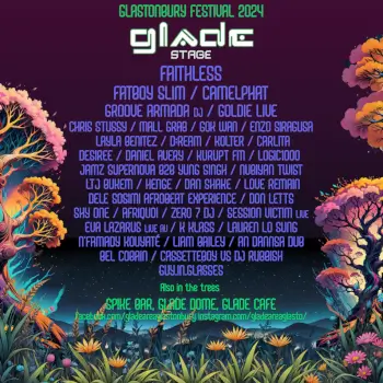
 I did one last year, but probably haven’t got time to do an extensive one this time. But happy to start one and make it editable for others to add to it as well, combined effort.
 -
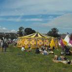
 What did you like so much about it. Camped in big ground last year. Really liked it with looking over the pyramid but was quite far away from everything else. With most of the acts I want to see on the other this year I think I’ll move
 -
By MEGATRONICMEATWAGON · Posted
Wooooooooahhhhhh! This is massive! Congrats! -
By MEGATRONICMEATWAGON · Posted
Thanks! Going to use this as my first listening guide!
-
-
Latest Festival News
-
Featured Products
-
Hot Topics
-
-
Latest Tourdates


Recommended Posts
Join the conversation
You can post now and register later. If you have an account, sign in now to post with your account.