


PolygonWindow
-
Posts
483 -
Joined
-
Last visited
Content Type
Profiles
Forums
Blogs
Gallery
Store
Posts posted by PolygonWindow
-
-
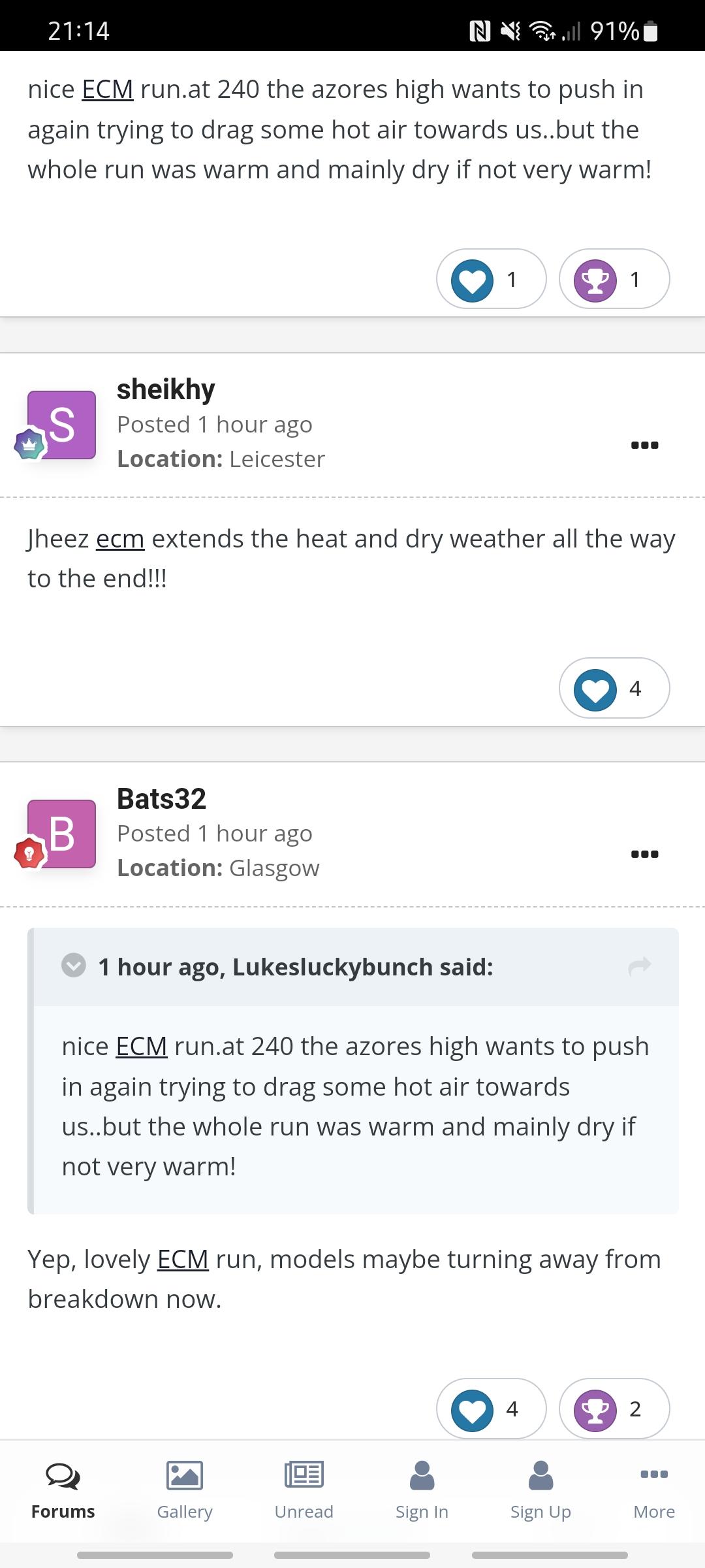
5 minutes ago, Euphoricape said:
Can't see it on there..?
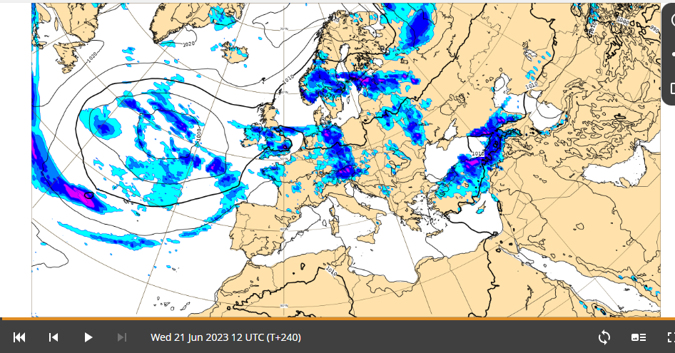
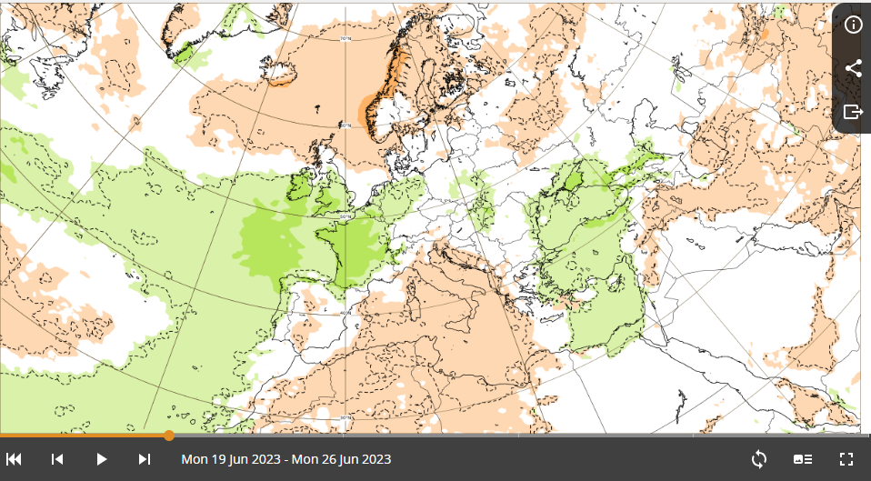
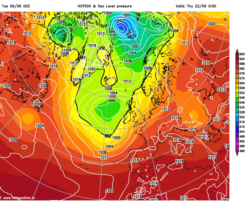
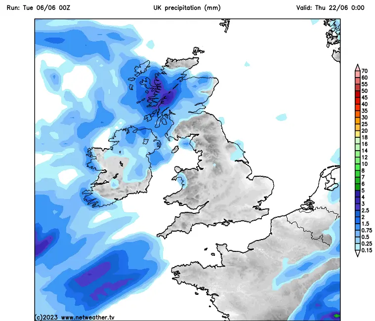
This is the discussion from most recent ecm run on the site:
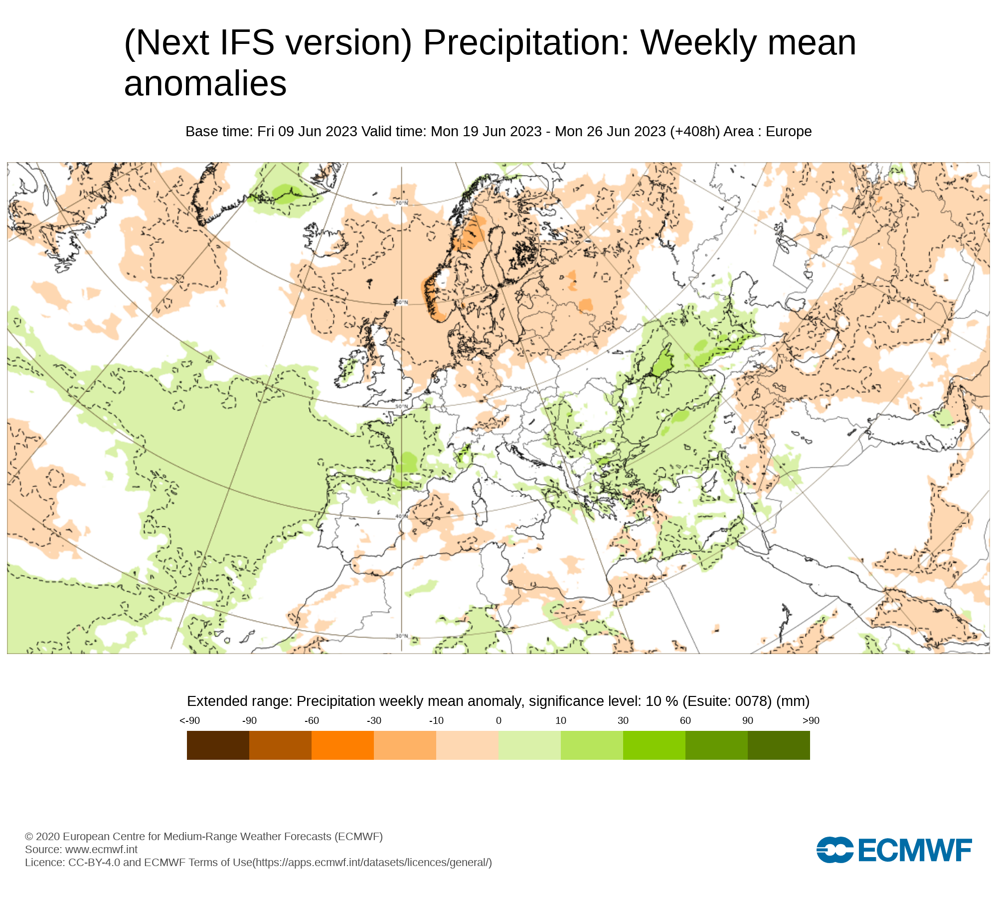
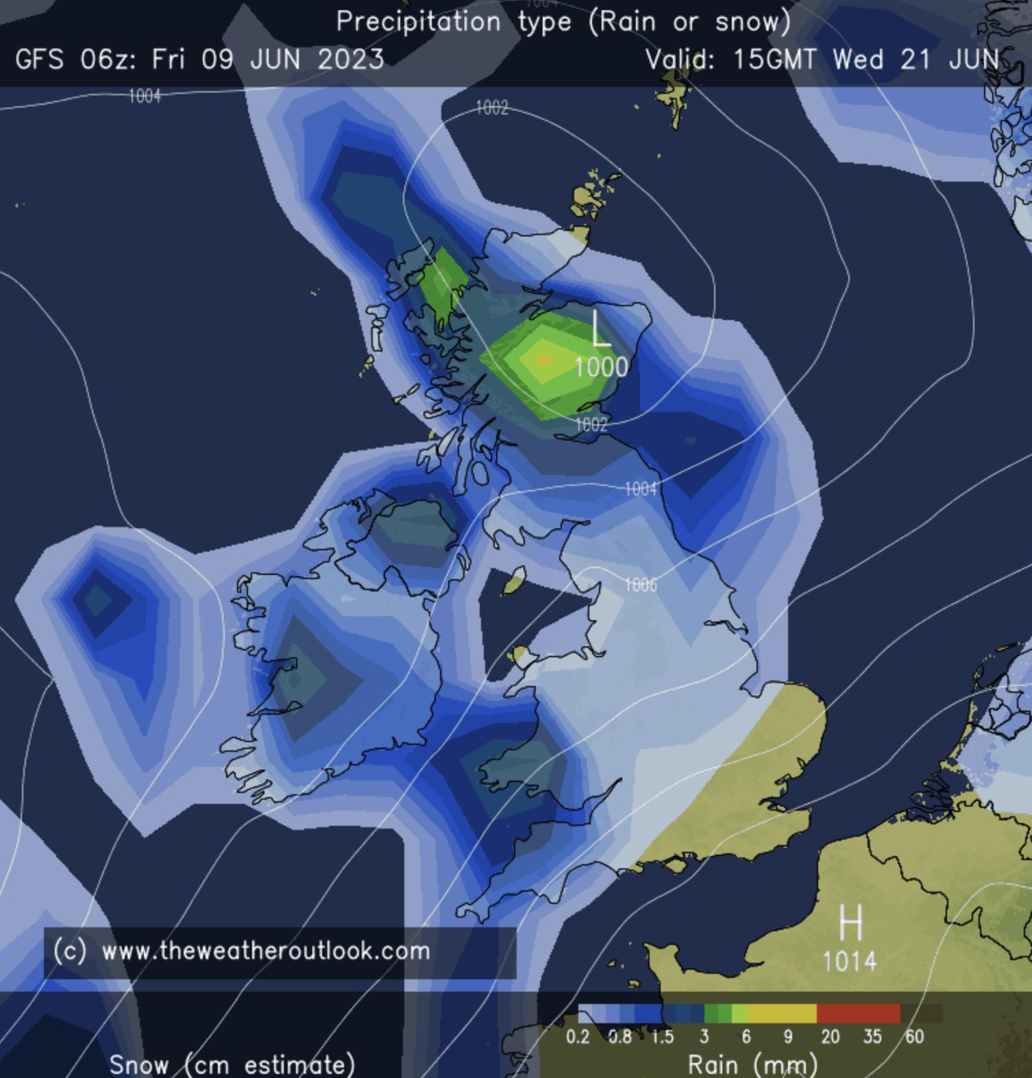
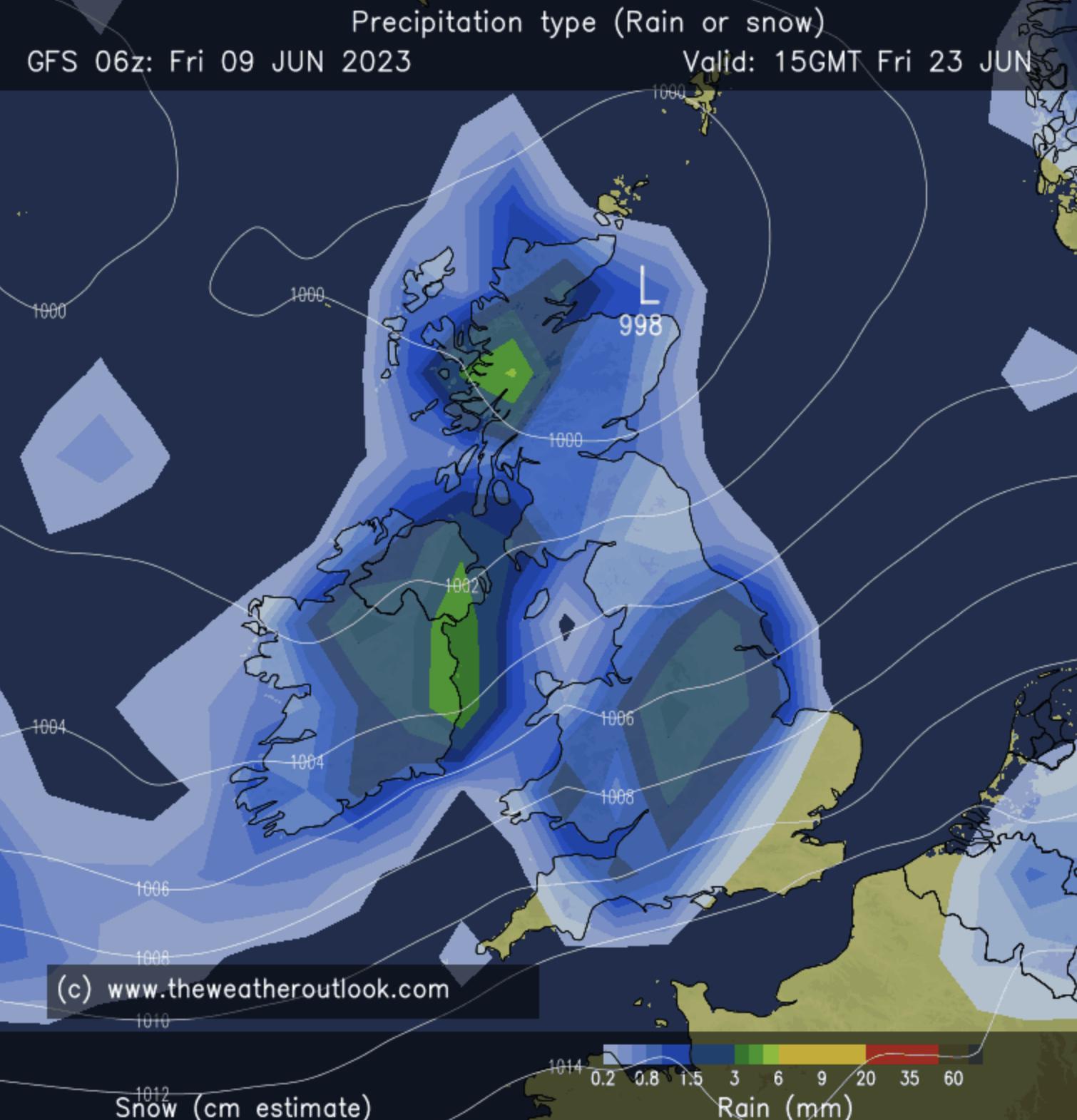
Extended run (showing weekly avg rain for festival week):
medium range (showing rainfall up until the Wednesday gates opening):
I guess the guys on that forum think this run potentially looks better than the previous and the risk of a breakdown is reducing? Not sure how the extended stuff works tbh but it updates daily on the IFS version about 9pm. Medium range twice in morning and evening.
-
 1
1
-
-
Just now, Euphoricape said:
Which model is this?
ECMWF daily runs. Called IFS on their site!
-
Yeah, this ain't good. Probs our biggest blow yet given we've been slagging the GFS off in favour of this ECMWF.
-
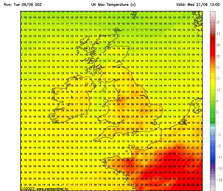
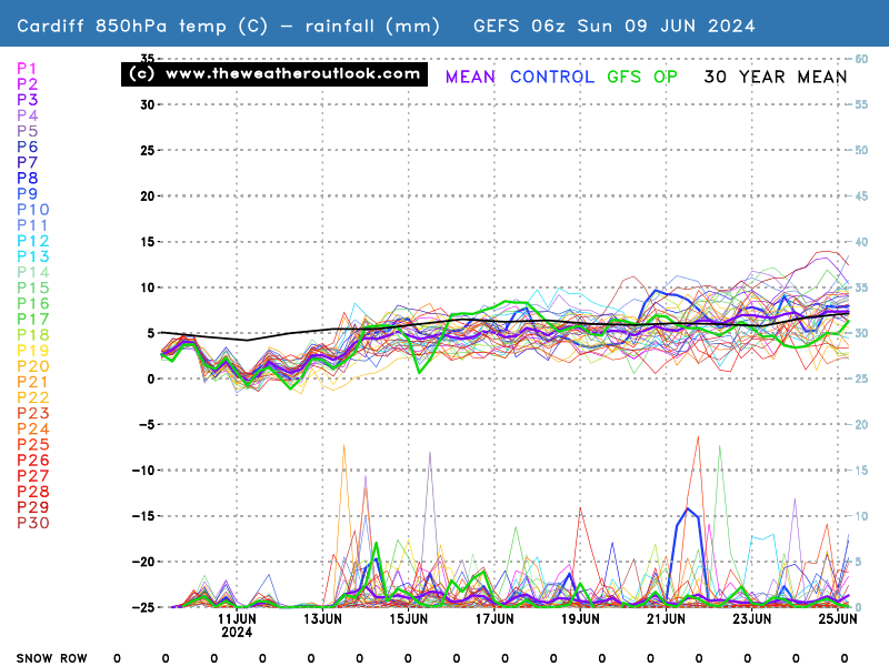
6 minutes ago, DYRTFT said:
Latest GFS run(12Z):
Wed: Light rain on and off most of the day with chance of a bit of heavier stuff, clearing a bit later in the evening. Max temp 17
Thu: That theme continues into Thursday with light rain on and off all day, clearing in evening. Max temp 18 (almost identical to Wednesday)
Fri: Mostly dry with chance of light rain in afternoon but clearing in evening. Max temp 19
Sat: Light rain in the morning but that clears and remains dry the rest of the day. Max temp 20
Sun: Dry in the morning, light rain in afternoon. Max temp 23
(Getting closer but still TOO EARLY)
Tuesday is horrendous on that run too. Very heavy rain.
I've noticed that in the Netweather forum they are really questioning the integrity of the GFS when it comes to low pressure coming in resulting in 'breakdowns'. Apparently it has a consistent track record of exhibiting the worst possible scenario. ECMWF more reliable at this point.
-
GFS DISASTER
-
2 minutes ago, CaledonianGonzo said:
Keep giving me good news.
I know it’s TOO EARLYtm, but this has been consistent with average rainfall for a few days now so looking good!
Fabrizio has HERE WE GO, we have ITS TOO EARLY.


-
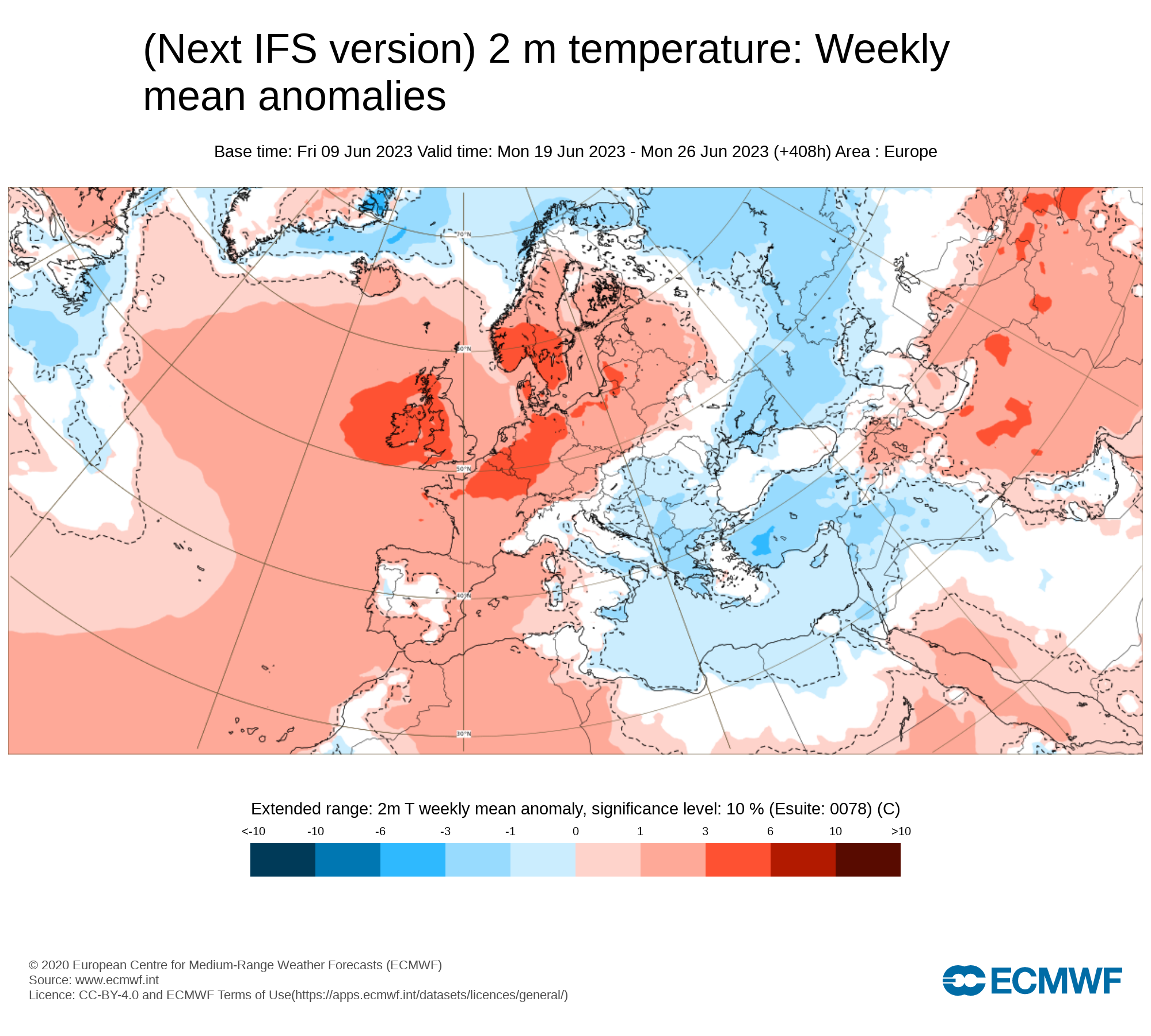
ECMWF IFS daily for today - well above avg temperature and avg rainfall for festival week. A welcome update given the state of the GFS.
-
1
-
-
Just now, Euphoricape said:
That's just noise
Just seems a whole load of waffle. Hurting my head trying to work out Wed-Sun nxt wk lol
-
Don’t even understand this lol. Timescales all over the gaff
-
7 minutes ago, Jacko45 said:
I'd so deeply sad if it rained every day at my debut Glasto.

-
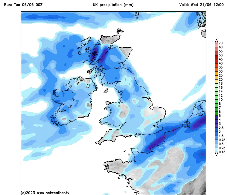
3 minutes ago, Sheffield Steve said:
The 6z GFS continues the theme it’s had for a few days now. Not good at all. Significant rain every day except perhaps the Sunday.
Wednesday rain:

Thursday rain: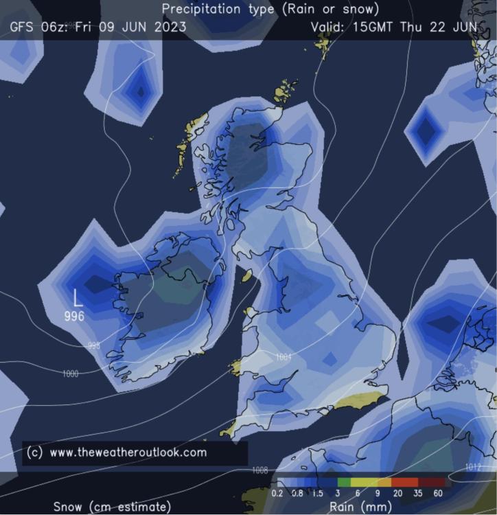
Friday rain:
Saturday rain: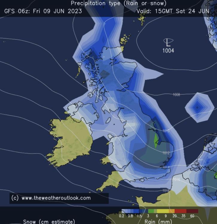
It’s giving us much more rain than the ECMWF at this stage. But who will be right? More runs needed…
It's had some good runs too!
-
ECMWF still showing average rainfall for the Glasto week. Got a lot better as we've got closer, last week it was showing above average.
-
12 minutes ago, squirrelarmy said:
I’m not posting pictures as MetCheck isn’t pretty today.
It’s looking like a drizzly one. Not heavy but constant rain. Could be that fine stuff that soaks you.
Hoping for a change.
They have a high of 15 degree Thurs lunchtime so don’t waste your time checking until closer in range 🙂
-
Absolute 100000% stick
-
I know it's TOO EARLY etc. but today I am starting to get the sense we are not trending in the right direction unfortunately. Looks as if next week is going to be nice and the week after not great. Want to be proved wrong tho obv.
-
3 minutes ago, 2019 said:
Saturday 17th afternoon is looking a bit shaky on the rain front, but this is right at the edge of the current forecast for GFS27 and GFS+ so take with a tablespoon of fancy Himalayan pink salt. ECMWF forecast is fairer, with lower winds.
This is how it currently shapes up.
Wed - dry/23c/NE. Evening looks especially nice with the wind tailing off.
Thur - dry/22c/NE. Evening similar to Wed.
Fri - mostly dry/23c/ENE. slight drizzle between 8-10pm, but nothing to worry about.
Sat - mixed/23c/NE getting windy. Dry morning, rain between 1pm and midnight, could be annoyingly persistent.
Sun - not in range, but the trends are lower winds, falling barometer, so less sunshine/cooler.
Thanks for the above. How are you getting the ECMWF detailed forecast that far into the future?
edit: just noticed this is for the week prior!
-
 1
1
-
-
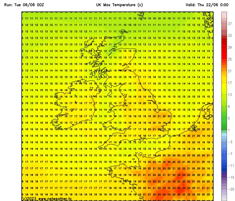
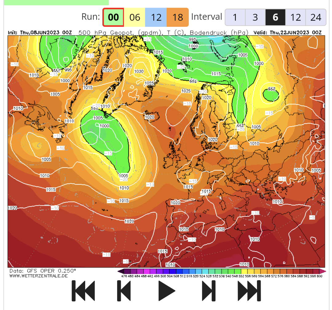
3 minutes ago, Jackomanaco said:
Yep. The 1200 run yesterday was awful. The two runs since have been better. Midnight run does have a looming low to the west Thursday but it does look like the high ridge is strengthening a bit as the festival goes on.
1200 Run (Thursday)
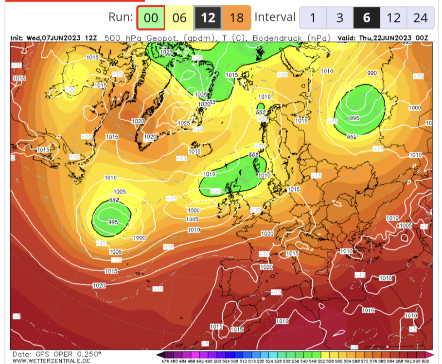
0000 Run (Thursday)

That low under us/ coming south eastern from Europe is proper annoying me
-
Just now, Drinky said:
It is trending in an absolutely horrific direction right now
‘Wetter than average’ is not a horrific direction 2 weeks out.
-
Just now, FuzzyDunlop said:
Dont threaten me with a good time.
It wont last
That’s borderline Nal from you pal!
-
23 minutes ago, Sasperella2 said:
Metcheck currently not making for pretty reading. Rain every day on the run up and then near on 10mm Thurs/Fri.
And a high of 16 degrees on the Wed, it’s complete bs.
-
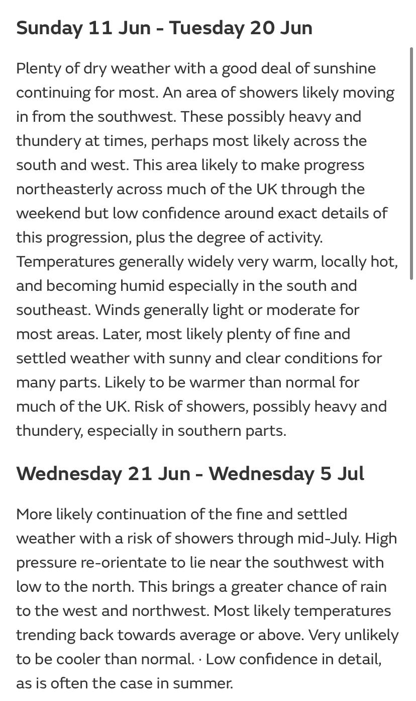
Update from Met Office. P sure it’s meant to say Mid June as opposed to Mid July.
-
4 minutes ago, The Nal said:
Mud is fine. Not preferable obviously but rain is a serious pisser.
Nal is human?!
-
4 minutes ago, Alvoram said:
Not too bad, less than 10mm on the few days up to the wednesday... still twist (just hope it doesn't get worse.)
(P.s that is the GFS, but it's the ensembles)Hopefully just a dud run across the board then!
-
1 hour ago, Alvoram said:
00z is a bit of a disaster... But we'll just call it an outlier...
------------------------
Wednesday
------------------------
Thursday (00:00)
Definitely an outlier.... TWIST
GEFS has got the most biblical rain ever. Must be based on that GFS. TWIST!


The Weather Thread 2023
in Chat
Posted